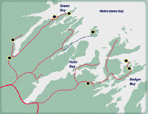
Green Bay Trails
Click trail markers for more info
1
2
3
4
5
6
7
8
ALEXANDER MURRAY |
North Shore Forest |

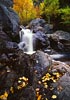
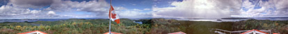
An extensive trail system, leaving the town of Kings Point at sea level to ascend to an elevation of 1200 feet. The summit overlooks the deep fjord of Southwest Arm, stretching out to Green Bay. The ascent is up a long stairway and through a deep gorge with waterfalls.(right) The circuitous route decends beneath the Haypook summit to moose barrens.
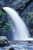
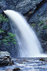
RATTLING BROOK FALLS |
North Shore Forest |
Just a short distance from the Alexander Murray trail, a 10 minute hike takes you to the base of a 250m waterfalls made accessible by walkways and steps. The best times to visit are in spring or fall when higher water levels create a thundering cascade. For pictures, midmorning sunlight shines directly into the crevace.
OCEANVIEW |
North Shore Forest |
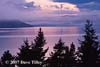
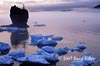
A 1.5 km loop with boardwalks to the Langdons Cove Arch and Partridge Point lookouts. The trail offers scenic views of Green Bay into the mouth of the long fjord, Southwest Arm. Occaisionally icebergs can be seen in spring and whales from spring to fall although the best time is during the capelin run in early July when Humpbacks cruise the shoreline for spawning capelin that roll on Nickys Nose beach.

KINGS COVE |
North Shore Forest |
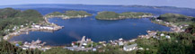
Accessible from the Trans Canada Highway via Springdale (route390) to Kings Point then to Harrys Harbour via route 391. A 5km system of trails run for 5kms through the abandoned settlements of Kings Cove and Budgells Cove enroute to Green Bay Island Tickle. The main trail is accessible by ATV. Short walking trails branch to Starkes Cove, Back Cove and a loop back to Harrys Harbour via the Gull Cliff lookout which offers a panoramic view of Notre Dame Bay. It winds through pastures and old growth balsam fir forests and is the most oceanic of the regions trails.
LITTLE BAY ISLANDS |
North Shore Forest |
Accessible by a 45 minute ferry ride from Shoal Arm near St.Patricks the island has a network of coastal and inland hiking trails. With access to lookouts using boardwalks and steps, Gull Hill offers a panoramic view of Notre Dame Bay and its many inlets and islands. Pole Hill overlooks the harbour and town of Little Bay Islands with its uniquely traditional lifestyle.
BRIGHTON COASTAL |
North Shore Forest |
Accessible by a bridge across the tickle, Brighton Island is the last stop in Halls Bay. The rugged cliffs covered with stunted spruce and fir are made accessible by walkways and natural trails offering a unique look at the area.


MAPLE RIDGE |
North Shore Forest |
The islands are a boaters paradise with many coves and tickles to explore. The communities of Triton and Brighton, sheltered between the rolling hills have a long fishing tradition. The trails lead to lookouts offering a wide view of the greater area and the sea.


HAZELNUT |
North Shore Forest |
10 km of trails pass camp grounds and a dock with picnic and resting areas before crossing the narrows to round a section of Crescent Lake near the town of Roberts Arm. Two lookouts offer a wide view of the lake and the Tommys Arm salmon river. The area is blazing with color in the fall when the predominant birches, aspens and maples are best seen.

