Click map
locations for
more info.
St. Pauls Inlet
Western Brook
Bonne Bay
Tablelands
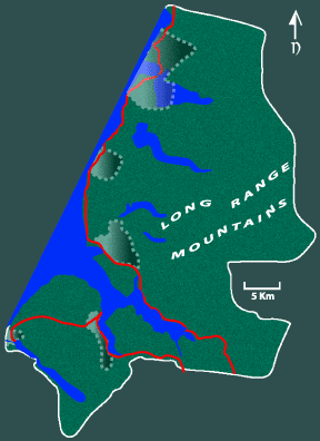
Gros Morne
Southeast Hills
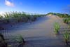
Shallow Bay
Green Gardens
Mouse over
thumbnails for enlargements
Gros Morne National Park
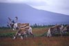
Gros Morne is a very diverse landscape encompassing a large portion of the islands west coast. It straddles three eco-regions, the Western Forest, Northern Peninsula Forest and Long Range Barrens. Mountainous terrain gives way to a flat coastal delta that was once the sea bottom. Deep fjords cut into the mountain plateau have since been landlocked to become fresh water ponds. The mountainsides are still heavily forested with primarily Balsam Fir. These areas are home to one of the worlds greatest concentrations of Moose. Caribou live on the barren plateaus and sometimes migrate to the lowlands. The highway follows the coast through traditional outports which continue normal activities within enclaves that are outside the parks jurisdiction. Although some of the smaller settlements were removed when the park first came into existance the remaining population has benefited from a booming tourism industry while maintaining most of their traditional rights. Traffic throughout he area is high from early June until late Sept. but the roadstops and planned trails keep most travellers away from the parks most remote areas thereby allowing them to maintain their value for hardcore wilderness fans.
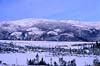
Shallow Bay |
 |
 |
 |
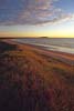 |
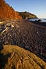
Just North of Cow Head, a wide swath of sandy beach gives way to rolling dunes.
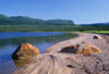
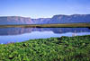
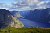
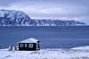
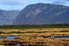
St. Pauls Inlet |
 |
 |
 |
 |
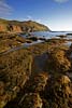
A saltwater lake with a narrow opening to the ocean has very shallow sections at low tide. Home to waterfowl and shorebirds, one of the few places where harbour seals can be found during summer.
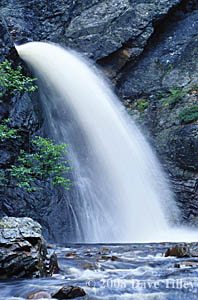
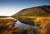
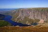
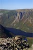
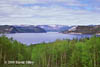
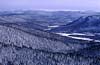
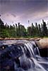
Western Brook |
 |
 |
 |
 |

Its headwaters in the Long Range Mountains, the brook flows through the long winding gorge of Western Brook Pond and continues to snake across the coastal delta through peatlands before emptying into the Gulf of St. Lawrence along a stretch of wide sandy beach amidst the dunes.
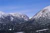
Gros Morne Mountain |
 |
 |
 |
 |
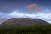
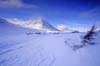
At the heart of the park the grey dome shaped limestone plateau for which the park is named is its highest mountain affording spectacular views of the Long Range Mountains to the east and the Gulf of St. Lawrence to the west.
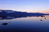
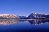
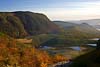
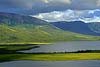
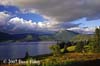
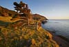
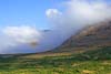
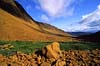
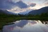
Bonne Bay |
 |
 |
 |
 |
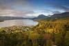
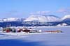

Clusters of traditional fishing communities can be found on the North and South shores of Bonne Bay. The arms of the sea stretch far inland meeting the mountains. At there base above the shoreline the highway winds through a long scenic route that includes grand vistas of the Tablelands, Southeast Hills, Killdevil and Gros Morne Mountain.
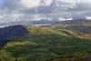
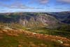
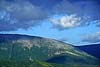
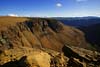
Southeast Hills |
 |
 |
 |
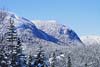 |
Towering over the eastern shores of Bonne Bay, the Southeast Hills are a varied landscape of glacial features, dense forest, bogs and barrens.
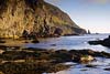
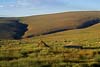
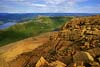
Green Gardens |
 |
 |
 |
 |
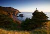
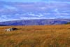
In contrast to the gravel seashore north of Bonne Bay bordered by a well travelled highway, steep mountains tower over remote southern shores. Traversing for several kilometers of rugged coastline Green Gardens is a ledge of green meadow where sheep graze in tranquil solitude while seas below crash against rock formations of pillow basalt and volcanic ash and receding tides expose intertidal platforms inundated with kelp and pools that harbour communities of aquatic life.
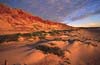
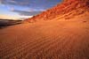
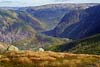
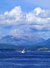
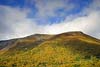
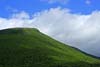
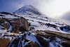
Tablelands |
 |
 |
 |
 |

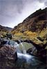
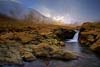
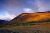
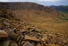
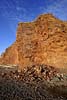
A collision of tectonic plates millions of years ago led to the upheavel of a portion of the earths mantle forming the highland plateaus of western Nfld. Iron bearing peridotite rock oxidizes to give the characteristic rusty brown color of the tablelands. A coating of sediments protected the rock from weathering until the glaciers of the last "ice age" left their mark on the land. The resulting barren rock has many easily recognizable features of glaciation, almost no vegetation and few animals.
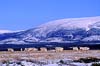
Wildlife |
 |
 |
 |
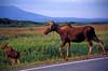 |
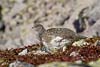
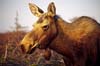


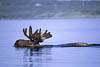
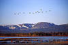
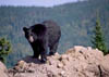

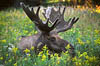
Best known for its record setting moose population, the large park area is home to many wild animals who inhabit diverse habitats from seabirds to waterfowl to mammals both large and small. Woodland Caribou that dwell in the mountains during summer taking advantage of late season ice packs and insect detering winds descend to the lowlands in fall and winter. The island population has unique characteristics and behaviours as do the Newfoundland sub species of Black Bear which is larger than its mainland counterpart.
![]()